
KTAG PRO
Higher precision outside. Positioning continuity inside.
KTAG Pro combines RTK-capable GNSS with inertial sensing, cellular connectivity and KPT positioning intelligence for applications that require precise outdoor positioning and continued indoor awareness.
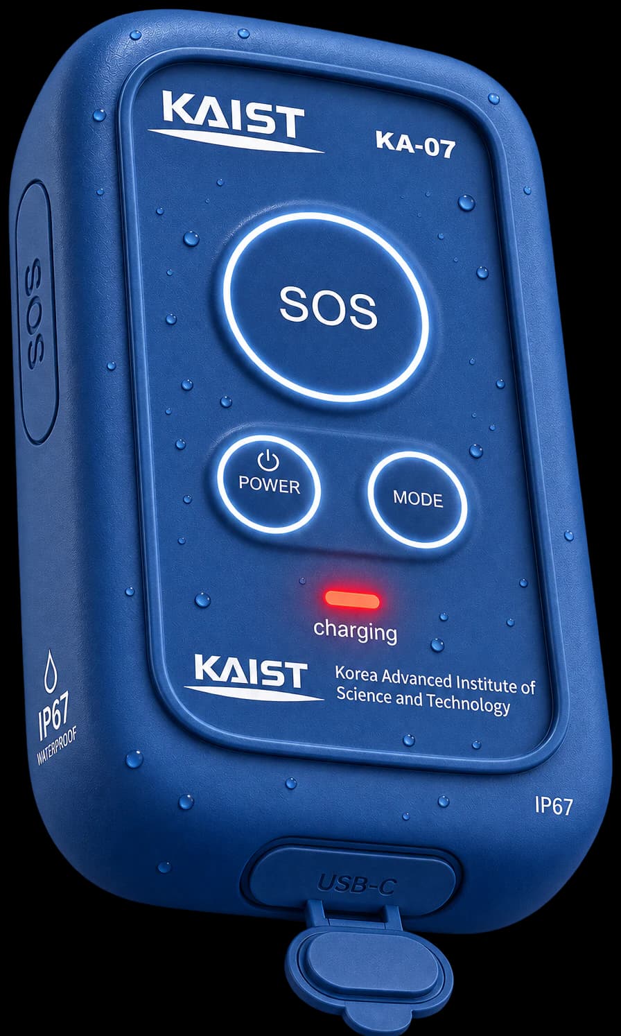
- RTK GNSSDual-band L1 / L5
- SOS, Power and Mode controls
- LTE Cat-MCloud positioning engine
- USB-C port
RTK GNSS
Precision where the sky is visible
RTK GNSS is designed to improve outdoor position accuracy when suitable correction information and satellite conditions are available.
POSITIONING CONTINUITY
Continuity as the environment changes
Precision outdoors solves only part of the positioning problem. KTAG Pro is designed to connect high-precision outdoor positioning with the inertial and positioning technologies required when a user enters a building or other GNSS-challenging environment.
- GNSS
- RTK GNSS
- Sensor Fusion
- Environment Detection
- Inertial
- Wi-Fi
- Map
- Pressure
POSITIONING SYSTEM
A positioning system, not just a receiver
Motion sensing, altitude information, connectivity and positioning software make KTAG Pro a platform for location-aware operational workflows rather than a standalone coordinate display.
- Motion sensing
- Altitude information
- Connectivity
- Positioning software
Location-aware operational workflows
LIVE ESTIMATION
Precision outside. Continuity inside.
KTAG Pro keeps a field of candidate positions alive around the wearer. Outdoors, RTK GNSS draws the field tight; through the door, motion sensing and the shape of the building take over, ruling out every position the wearer could not have reached.
TECHNICAL OVERVIEW
KTAG Pro at a glance
- Outdoor positioning
- RTK GNSS
- RTK accuracy target
- ±2 cm
- Dual-band GNSS
- L1 / L5
- Connectivity
- LTE Cat-M
- Motion sensing
- Accelerometer / Gyroscope / Magnetometer
- Altitude sensing
- Pressure sensing
- Protection
- IP67
- Positioning software
- Cloud positioning engine
- User controls
- SOS / Power / Mode
- Port
- USB-C
APPLICATIONS
Where precision and continuity both matter.
High-precision field operations
Critical infrastructure
Emergency response
Defense and mission-critical teams
Industrial safety
SOLUTIONS
Where KTAG Pro fits
Defense & Mission-Critical
Extend positioning awareness into operational environments where relying on satellite positioning alone may not be sufficient.
Explore Defense & Mission-CriticalEmergency Response
Support responders with location information as they move from open outdoor areas into structures where satellite signals may become unreliable.
Explore Emergency ResponseWorkforce Safety
Improve situational awareness for teams working across factories, construction sites and other complex environments.
Explore Workforce Safety